What Is Pangaea? Piecing Together the Supercontinent Jigsaw Puzzle
DEFINITION:
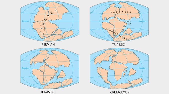
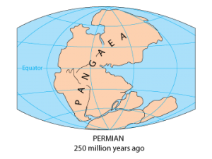
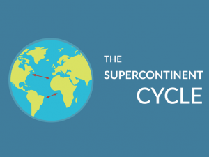
Pangaea was a supercontinent that existed around 200-300 million years ago, where all of Earth’s continents were joined together in one large landmass.
Pangea Supercontinent
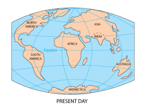
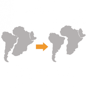
About 200 to 300 million years ago, all the continents were connected together as one giant supercontinent known as Pangaea. Over time, these continents have broken apart into 7 continents and 5 oceans.
We know they were together because it’s not only that continents fit together like a puzzle.
But we’ve found the same types of rocks on the west coast of Africa and the east coast of South America. This means they must’ve formed when the continents were together.
We’ve also found the same types of plants and animal fossils on both coasts. We know that plants couldn’t float across the ocean and animals couldn’t swim.
Why did people not believe Pangaea existed?
Back in the 1700s, people believed that the size and shape of the continents were the same for millions of years.
In other words:
If you looked at a map now and compared it to a map millions of years ago, they would be exactly the same.
In the 1400s, cartographers created maps similar to the ones we see today. But there was something that stood out in these maps:
Could all these pieces fit together somehow? For example, the Atlantic coast of Africa and South America connected particularly well.
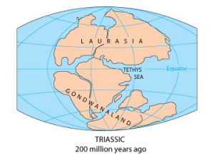
Eduardo Suess’ supercontinent theory of “Gondwana”
The general consensus from scientists in the late 1800s was that the continents have remained as they have for millions of years. No one believed the continents all tore apart from each other.
EDUARD SEUSS: Except when an Austrian geologist by the name of Eduard Suess theorized the idea of the supercontinents in 1861.
He proposed the world was all connected as one giant continent “Gondwana” at one time. He also theorized that there was one giant ocean – “Tethys Ocean”
But the scientific community still questioned the idea of supercontinents. Indeed, the world fit reasonably well but it didn’t fit perfectly.
Alfred Wegener’s supercontinent theory “Pangaea”
German geographer Alfred Wegener introduced the idea of piecing the world at continental shelves. Instead of at the landmasses you see from above, the water levels off at the continental shelf.
Now, if you cut each continent and island at the continental shelf, they match even better. And he was right, as the correlation did improve.
ALFRED WEGENER: In 1912, Alfred Wegener thought that all continents were connected as one giant landmass called “Pangaea” (sometimes spelled “Pangea”). He also introduced the idea that 200 million years ago, Pangaea tore apart. It was plate tectonics that drove continental drift and the moving of continents.
Finally, we had an answer for where the energy could come from to pull continents apart. It was plate tectonics and continental drift which had enough tensional force to split continents apart.
Again, the idea was disliked amongst scientists and really not accepted. But even today, Alfred Wegener’s theory of plate tectonics and the supercontinent Pangaea is the most established and recognized.
Why is plate tectonics important?
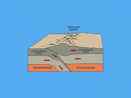
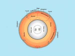
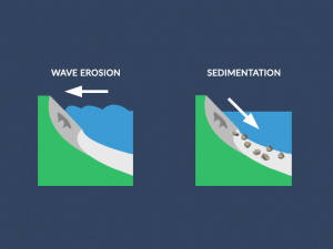
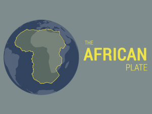
The Earth’s crust has 15 or 20 separate pieces. The reason why they look like they do is that they broke apart. The Atlantic Ocean actually formed when the continents of Africa and South America moved away from each other.
These pieces (plate tectonics) ride on soft melted rock called the asthenosphere underneath. If you’re making new ocean bottom in one place, somewhere it’s getting rid of it. Because the Earth is staying the same size. So where does old oceanic crust get consumed into the mantle again?
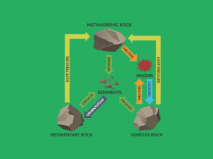
Deep-sea trenches are where the oceanic crust goes beneath. For the volume that you make at an oceanic ridge, the volume dissolves at deep-sea trenches. The start of this process is at deep-sea trenches. They break and dive down into the mantle getting re-consumed at zones of subduction.
Since the formation of Pangea, the continental landmass has gone through addition and subtraction. New land is being formed and destroyed every day as part of the rock cycle. As the Earth is billions of years old, it has undergone significant change due to plate tectonics.
Additional Resources
Pangea Interactive Map Viewer
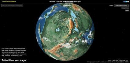
Do you want to see what Pangea looked like 240 million years ago? Or do you want to see how the landmasses evolved into how it looks today? In this interactive map (Dinosaur Pictures), you can see the ancient Earth.
You can also go back to the first multicellular life, first plants, and first plants. Or if you want to see the Pannotia supercontinent, you can also see how this looked 600 million years ago… More than 300 million years before Pangea.

Watching the spoiler video on r/dragongiants it shows the body parts of the world outlined. Shows why our earth is round. Shows why Pangaea is a trash theory. Shows a lot y’all can’t handle. Please stop spreading lies and misinformation thank you
The answer you are looking for James is Civilisation had to wait for the end of the ice age, which terminated about 15,000 years ago. At that time the glaciers had piled up a lot of good topsoil at its edge, and the melting ice provided plenty of water. Agriculture was developed for the first time in human existence, at first in Turkey.
Great! I love this web site. Learned a lot. Thanks
Given the estimated age of the Earth (4.543 billion years) why did it take so long for the species of man to appear?
Can there be some more evidence for how Pangea existed????
Nice article. Poor writing style.