How Does Topography Affect Climate?
The Effects of Topography on Climate
How does topography affect climate? Topography is like nature’s architect for climate, influencing temperature and weather.
Mountains, for instance, can block rain, creating dry areas. Valleys often see different temperatures compared to nearby hills.
Understanding topography helps us grasp climate’s complex puzzle. Here are some examples of how topography affects climate.
“Mountains are the architects of climate. Valleys are its sculptors.”
1. Mountain Rain Shadow Effect
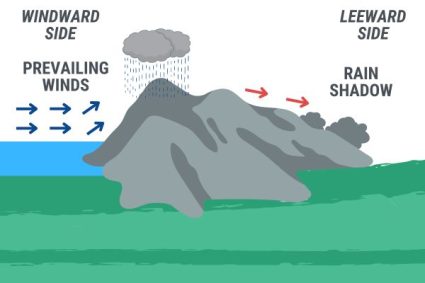
Mountains can create wet climates on one side and arid regions on the other. It starts when moist air hits a mountain range. As the air rises, it cools and condenses, causing heavy rainfall on the windward side.
Now, on the leeward side, it’s a different story. Here, the air descends, warming up and drying out. This creates a “rain shadow,” an area with significantly less rain.
For example, the Sierra Nevada mountains create a rain shadow effect. This leads to the dry conditions in Nevada’s deserts.
2. Altitudinal Zonation
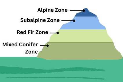
Altitude zonation leads to different vegetation and weather patterns at different heights. It refers to how climate changes with altitude.
As we climb higher, temperatures generally drop. This leads to different ecosystems at various heights. For instance, you’ll find lush forests at lower altitudes.
But as you go higher, forests give way to alpine meadows and eventually snow. A classic example is the Andes Mountains, where diverse ecosystems exist from base to peak.
3. Coastal vs. Inland Climates
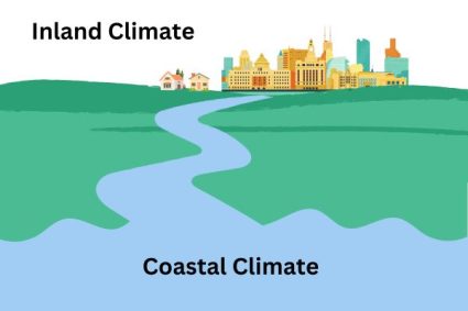
Topography influences temperature and humidity in coastal and inland climates. Coastlines enjoy the moderating influence of oceans. This means milder winters and cooler summers.
In contrast, inland areas experience more extremes. Their winters are colder and summers are hotter. This difference is due to the ocean’s ability to store and release heat slowly.
For example, San Francisco has a mild climate, while nearby Fresno, inland, has more extreme temperatures. Because of the distance from the ocean, this can significantly influence local climates.
4. Influence of Valleys and Basins
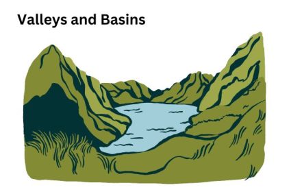
Valleys and basins can trap air and lead to unique microclimates. In valleys, air can be trapped, sometimes creating warmer conditions.
Basins, on the other hand, can become heat sinks. They’re notorious for extreme temperatures, both high and low. This effect is amplified in enclosed areas with little wind.
An example is Death Valley National Park, one of the hottest places on Earth. It’s so hot because of its basin-like topography and below-sea-level elevation.
5. Topography and Wind Patterns
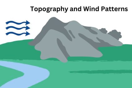
Topography significantly impacts wind patterns. Mountains, for example, act as barriers redirecting wind flow. This can lead to varied wind patterns on either side of a range.
In valleys, winds tend to funnel through, sometimes speeding up. Coastal areas experience sea breezes, thanks to differences in land and water heating.
Topography can also create unique local winds. For instance, the Mistral wind in France is a result of the region’s specific topographical features.
How Does Topography Affect Climate
In conclusion, topography is a key player in climate dynamics. Each landform brings its unique twist to the weather, from mountains to valleys.
These natural structures shape wind patterns, influence temperatures, and even dictate rainfall. So, it all boils down to this: topography shapes our climate in ways as complex as nature itself.
Do you have any questions? We’d love to hear from you. Please give us your feedback in the comment section below.