What Is the Prime Meridian?
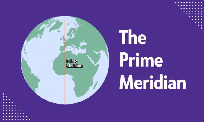
The Prime Meridian is an invisible line that splits the Earth into the Eastern and Western Hemispheres. It passes through Greenwich, London, which is why it’s often called the Greenwich Meridian. Because of this line, we can accurately measure time and longitude.
The Prime Meridian is the zero-degree longitude line from which we measure east and west on the Earth’s surface.
Where Is the Prime Meridian?
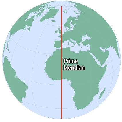
The Prime Meridian is located at zero degrees longitude. We use it as the starting point for measuring distance both east and west around the Earth.
This line runs through the Royal Observatory in Greenwich, London. This is why we also call it the Greenwich Meridian. From there, it stretches from the North Pole to the South Pole, crossing various countries and seas.
When Do We Use the Prime Meridian?
We mostly use the Prime Meridian as a reference point in geography and timekeeping.
Geography
In geography, we use the Prime Meridian to determine latitudes and longitude coordinates. As for longitude, we use it to know how far east or west they are from this zero-degree line.
Any GPS uses latitude and longitude coordinates. This is key for plotting a course and for positioning. The Prime Meridian, along with the Equator, divides the Earth into a grid that makes precise positioning possible.
Timekeeping
For timekeeping, the Prime Meridian sets the standard for Greenwich Mean Time (GMT). This means local times around the world are defined by their distance from Greenwich.
For example, if you’re east of the Prime Meridian, your local time is ahead of GMT. But if you’re west, you’re behind GMT. So, the Prime Meridian influences how we navigate and synchronize our clocks.
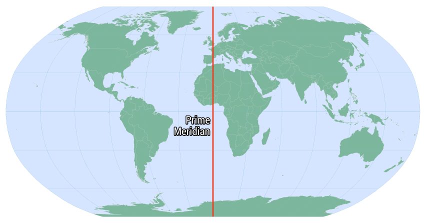
Longitude Lines Map
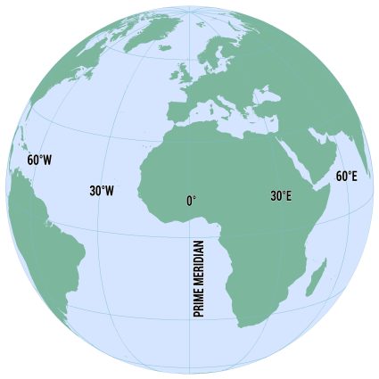
As mentioned, lines of longitude are lines that run from the North Pole to the South Pole. They measure the distance east or west of the Prime Meridian, the zero-degree longitude line.
This means the Prime Meridian divides the Earth into the Eastern and Western Hemispheres. Each line of longitude is numbered from 0° at the Prime Meridian to 180° east or west.
As you move away from the Prime Meridian, the longitude increases until it reaches 180°. This is where it meets the International Date Line in the Pacific Ocean.
So, lines of longitude, together with lines of latitude, create a grid system. This system allows anyone to pinpoint any location on Earth accurately.
The History of the Royal Observatory
A long time ago, navigation was a mess because countries often had their own systems. This confusion made navigation of any sort risky. As a result, it was clear that we needed a single standard of positioning.
In 1884, leaders gathered in Washington, D.C., to solve this. They debated many options. Finally, they agreed on the line running through Greenwich, England. This choice became the Prime Meridian in England.
Now, this line guides all global maps. It ensures ships and planes navigate safely. Plus, it unified the world’s clocks. So, thanks to the Greenwich Meridian, this decision helped standardize time and geographical measurements worldwide.
The Prime Meridian
The Prime Meridian brought the world together by making travel and timekeeping the same everywhere.
Interestingly, the Prime Meridian passes through different countries, including the United Kingdom, France, Spain, and Algeria, among others.
Do you have any questions about the Prime Meridian? We’d love to hear from you in the comment section below.
A Visual Guide to Our Solar System [Infographic]
5 Comet Facts: Dirty Snowballs of the Solar System
Chandler Wobble: Why Earth Wobbles Like a Toy Top
Sun Fusion: How the Sun Heats Up Earth
A Guide to Earth’s Lithosphere
Earth Age: How Old Is the Earth?
10 Colossal Facts About the Gas Giant Planet Jupiter [Infographic]
Moon Gravity: Your Weight on the Moon
What is Earth’s Escape Velocity?
Milky Way Galaxy: 200 Billion Stars and Our Solar System
10 Planet Venus Facts [Infographic]
100 Earth Facts: A Scientific List of Facts About Earth
Planet Formation and the Core Accretion Theory
7 Red-Hot Planet Mercury Facts [Infographic]