10 Longest Rivers in the United States
Rivers are the lifeblood of the United States, weaving through each and every state. Among them, ten rivers stand out for their impressive lengths. In this article, we’ll explore the 10 longest rivers in the U.S., from the Mississippi to the Yukon River.
1. Missouri River
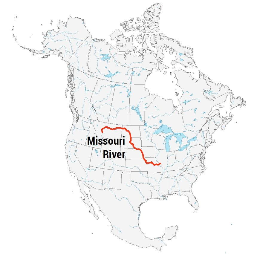
The Missouri River is a giant in the U.S., stretching over 3,768 km (2,341 miles). It starts in the Rocky Mountains of western Montana. From there, it flows east and south through several states.
It passes through North Dakota, South Dakota, Nebraska, Iowa, Kansas, and Missouri. The river finally meets the Mississippi River near St. Louis, Missouri.
The landscape along the Missouri River is diverse. In Montana, it flows through narrow, rocky canyons. As it moves eastward, it winds through wide, flat plains. This makes the river a water source for farming.
2. Mississippi River
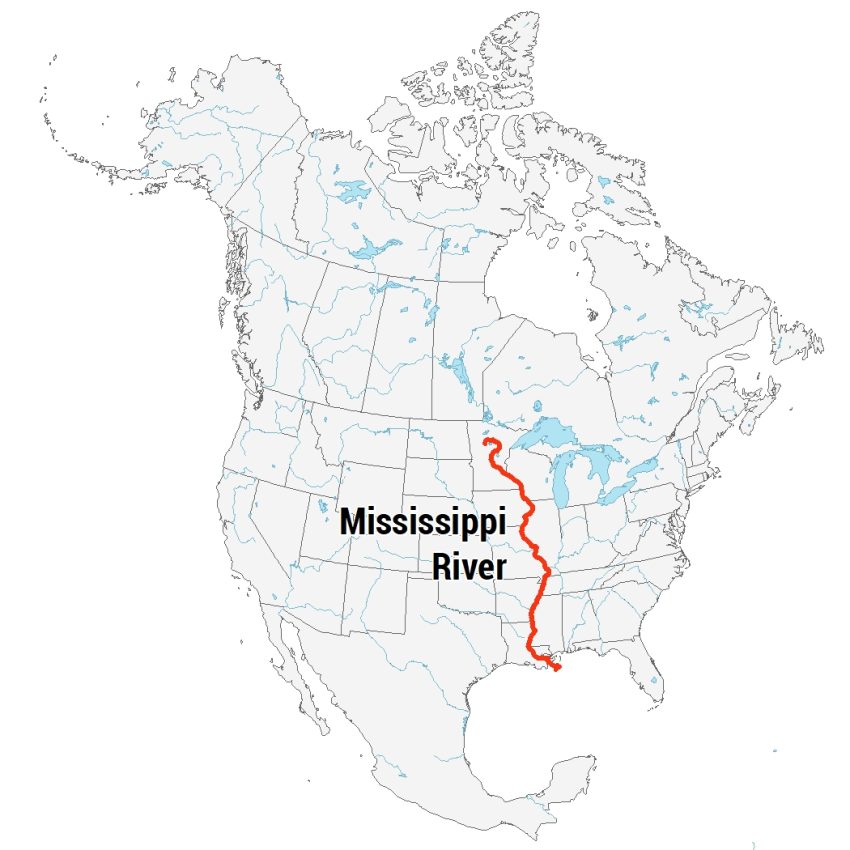
The Mississippi River is known as the backbone of America. It starts small in Minnesota, at Lake Itasca. Then, it travels about 3,766 km (2,340 miles) south. Along the way, it touches 10 states, including Wisconsin, Iowa, and Louisiana.
The river’s path is diverse. In the north, it’s narrow and swift, cutting through forests and bluffs. Further south, it widens, flowing slowly through vast plains and deltas.
The Mississippi also shapes the land around it. First, it’s perfect for farming. Secondly, its waters are home to countless species of fish and birds. Finally, it has a tremendous history in the United States.
3. Yukon River
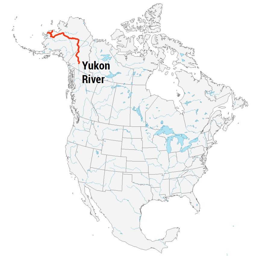
The Yukon River stretches about 3,190 km (1,980 miles). It starts in Canada, in British Columbia, then flows through the Yukon Territory. After that, it enters Alaska, USA, and finally reaches the Bering Sea.
Its journey is wild and remote. The river carves through rugged mountains and dense forests. In places, it’s wide and calm. But in others, it’s fast and choppy.
The Yukon River is home to salmon that travel long distances to spawn. This river also supports the communities along its banks by providing both food and a mode of transportation.
4. Rio Grande
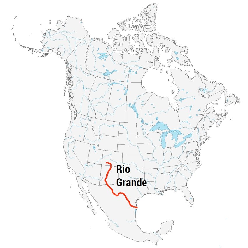
The Rio Grande River starts in the mountains of Colorado. Then, it travels 2,830 km (1,759 miles). It forms a natural border between Texas, USA, and Mexico for much of its length.
The path of the Rio Grande is varied. It flows through deserts, valleys, and canyons. In some areas, it’s wide and calm. In others, it’s narrow and fast.
The Rio Grande is crucial for water in a dry region. It supports farming and cities along its banks. The river also creates habitats for wildlife, especially birds.
5. Colorado River
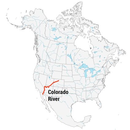
The Colorado River is a major river in the American Southwest. It starts in the Rocky Mountains of Colorado. Then, it travels 2,330 km (1,450 miles) to the Gulf of California in Mexico.
The river cuts through arid deserts and deep canyons. The Grand Canyon, one of its most famous sections, showcases its geologic history.
The Colorado River supplies water to millions of people and irrigates farms. Similar to the Rio Grande, it supports a variety of wildlife, especially fish and birds.
6. Arkansas River
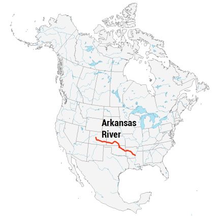
The Arkansas River begins in the Rocky Mountains of Colorado, flowing over 2,322 km (1,443 miles) to meet the Mississippi River. Its path is through steep gorges to wide, fertile plains. As it winds through Colorado, Kansas, Oklahoma, and Arkansas, it becomes a water source for agriculture.
The river’s geography changes dramatically along its course. In Colorado, it’s a mountain stream, fast and cold, cutting through rugged terrain. As it enters the Great Plains, it widens and its flow slows.
As a water source for communities across the heartland of America, it’s also a recreational hub for fishing, rafting, and hiking. You’ll find fish, migratory birds, and other types of habitat.
7. Columbia River
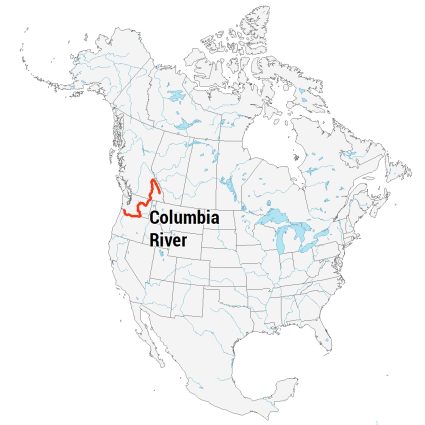
The Columbia River starts in the Rocky Mountains of British Columbia, Canada. Then, it flows through the U.S. states of Washington and Oregon, creating a natural border. Finally, the river empties into the Pacific Ocean.
The river is about 2,000 km (1,243 miles) long. Along its journey, it passes through forests, mountains, and deserts. The Columbia River Gorge is a famous section of the river, which is a canyon 4,000 feet deep.
The Columbia River is a major source of hydroelectric power, thanks to its many dams. In fact, there are more than 60 dams in the Columbia River watershed.
8. Red River
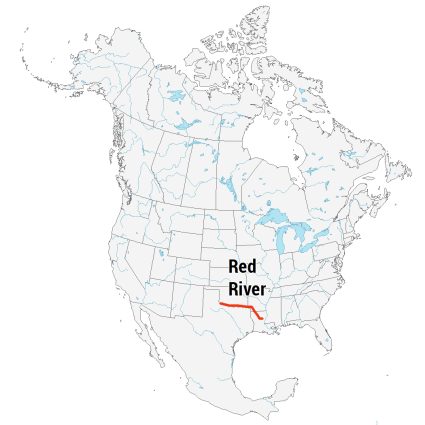
Not to be confused with the Red River in North Dakota and Minnesota… The Red River is a significant waterway in the southern United States.
It begins in the Texas Panhandle and flows eastward. As it travels, the river forms the border between Texas and Oklahoma. Then, it continues through Louisiana, eventually merging with the Atchafalaya and Mississippi Rivers.
The Red River is known for its reddish-brown water, which is due to the red soil it flows over. This river stretches over 1,811 km (1,125 miles), making it one of the major rivers in the South.
9. Snake River
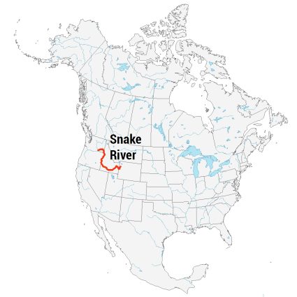
Snake River starts in the mountains of Wyoming, in Yellowstone National Park. From there, it flows westward, carving its way through Idaho. The river then turns north, forming part of the boundary between Idaho and Oregon. After that, it heads west again into Washington state.
Snake River is famous for its deep gorges and unique landscapes, like Hells Canyon, the deepest gorge in North America. It stretches over 1,674 km (1,078 miles).
Before reaching its end, the Snake River joins the Columbia River. This contributes to its flow into the Pacific Ocean. Similar to the Columbia River, the Snake River is home to several hydroelectric power plants.
10. Ohio River
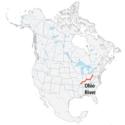
The Ohio River begins at the confluence of the Allegheny and Monongahela rivers in Pittsburgh, Pennsylvania. From there, it flows westward, winding through or along the borders of six states. They include Pennsylvania, Ohio, West Virginia, Kentucky, Indiana, and Illinois.
The river stretches for about 1,575 km (981 miles), making it one of the largest rivers in the United States by volume. Its wide, meandering path supports ecosystems, transportation, and recreation.
The Ohio River eventually joins the Mississippi River at Cairo, Illinois. Interestingly, the Ohio River was once a frontier boundary. It also played an important role in the westward expansion of the United States.
The Longest Rivers in the United States
These are the 10 longest rivers in the United States. Each one almost exceeds 1,000 miles in distance, sometimes forming natural boundaries between states.
We’d love to hear your thoughts about America’s magnificent rivers. Which ones have you experienced? Drop us a comment below to share your stories.

